

Join us in celebrating National Read a Map Day with this selection of books, government documents, and music!
The earliest road map, Britania Atlas, was drawn by cartographer John Ogilby in 1675. Fast forward a few centuries with new inventions such as satellites, GPS, and voice commands - times have truly changes! Do you know how to get around using a road map should batteries run low or a satellite connection becomes lost?
This day reminds us to sharpen those map reading skills!
Plan your next trip and discover new places with maps and travel guides available in Government Publications!
 The Slanguage of Travel
by
The popular Slanguage series has helped hundreds of thousands of enthusiastic fans learn to easily communicate better in foreign languages either while traveling abroad or at home. Now it takes on the topic of travel itself, presenting more than two dozen travel-related words and phrases in ten different languages. So if you're in France looking for a nice hotel(Bell Oh Tell), or if you'd like to know how much(Kwan Toe?) a souvenir from Italy costs, Travel Slanguageis the book for you.
The Slanguage of Travel
by
The popular Slanguage series has helped hundreds of thousands of enthusiastic fans learn to easily communicate better in foreign languages either while traveling abroad or at home. Now it takes on the topic of travel itself, presenting more than two dozen travel-related words and phrases in ten different languages. So if you're in France looking for a nice hotel(Bell Oh Tell), or if you'd like to know how much(Kwan Toe?) a souvenir from Italy costs, Travel Slanguageis the book for you.
 Transportation and Travel Handbook
by
Themes: Life Skills, Career, Achieve Independence, Skills, Travel, Transportation, Public Transportation, Nonfiction, Handbook, Teen, Young Adult, Hi-Lo, Hi-Lo Books, Hi-Lo Solutions, High-Low Books, Hi-Low Books, ELL, EL, ESL, Struggling Learner, Struggling Reader, Special Education, SPED, Newcomers, Reading, Learning, Education, Educational, Educational Books. Combining practical content with visual appeal, the 21st Century Life Skills handbooks read more like a magazine than a book. Highly readable with full-color photographs, a smaller trim size and an eye-popping layout, these 120-page handbooks are great for teaching life skills to a twenty-first century population. The 10 handbooks in this series will provide readers a thorough and non-threatening introduction to the multi-dimensional competencies, concepts, and vocabulary they need to achieve independences--including community resources, job searching, money management, job etiquette, health, moving and more. Used along or in conjunction with the 21st Century Life Skills worktexts, these handbooks offer students a unique and visual way to achieve real-world literacy. The handbook is a thorough and non-threatening introduction to: Off to a Good Start; Learning the Job; Succeeding on the Job; Workplace Problems and Solutions. This handbook offers students a unique and visual way to achieve real-world literacy.
Transportation and Travel Handbook
by
Themes: Life Skills, Career, Achieve Independence, Skills, Travel, Transportation, Public Transportation, Nonfiction, Handbook, Teen, Young Adult, Hi-Lo, Hi-Lo Books, Hi-Lo Solutions, High-Low Books, Hi-Low Books, ELL, EL, ESL, Struggling Learner, Struggling Reader, Special Education, SPED, Newcomers, Reading, Learning, Education, Educational, Educational Books. Combining practical content with visual appeal, the 21st Century Life Skills handbooks read more like a magazine than a book. Highly readable with full-color photographs, a smaller trim size and an eye-popping layout, these 120-page handbooks are great for teaching life skills to a twenty-first century population. The 10 handbooks in this series will provide readers a thorough and non-threatening introduction to the multi-dimensional competencies, concepts, and vocabulary they need to achieve independences--including community resources, job searching, money management, job etiquette, health, moving and more. Used along or in conjunction with the 21st Century Life Skills worktexts, these handbooks offer students a unique and visual way to achieve real-world literacy. The handbook is a thorough and non-threatening introduction to: Off to a Good Start; Learning the Job; Succeeding on the Job; Workplace Problems and Solutions. This handbook offers students a unique and visual way to achieve real-world literacy.
 Volunteer Vacations
by
If you are looking for a way to make a difference while on vacation -- simultaneously getting away and using your talents to improve the world -- this guide shows you how a short-term volunteer stint can transform your life as much as the people, animals, and ecology you choose to help. This fully updated edition is filled with in-depth information and profiles of 150 select organisations, over 40 new in this edition, running thousands of quality programs in the United States and around the world. Inside, you will discover ways to Excavate Jurassic Period dinosaur fossils in Wyoming; Work with women in their own microbusinesses in Ghana; Study wolves with field scientists in Slovakia; Help Haitians rebuild their homes; Organise activities for orphaned children in the Dominican Republic; Live and work with elephants in Thailand. Each listing includes complete contact information with locations, costs, dates, and project details you won't find anywhere else. It lets you know the work volunteers typically do and any special skills needed and highlights projects specifically tailored for families, seniors, and people with disabilities. Stories from recent volunteers and a host of new photographs help you further imagine your volunteer adventure.
Volunteer Vacations
by
If you are looking for a way to make a difference while on vacation -- simultaneously getting away and using your talents to improve the world -- this guide shows you how a short-term volunteer stint can transform your life as much as the people, animals, and ecology you choose to help. This fully updated edition is filled with in-depth information and profiles of 150 select organisations, over 40 new in this edition, running thousands of quality programs in the United States and around the world. Inside, you will discover ways to Excavate Jurassic Period dinosaur fossils in Wyoming; Work with women in their own microbusinesses in Ghana; Study wolves with field scientists in Slovakia; Help Haitians rebuild their homes; Organise activities for orphaned children in the Dominican Republic; Live and work with elephants in Thailand. Each listing includes complete contact information with locations, costs, dates, and project details you won't find anywhere else. It lets you know the work volunteers typically do and any special skills needed and highlights projects specifically tailored for families, seniors, and people with disabilities. Stories from recent volunteers and a host of new photographs help you further imagine your volunteer adventure.
 Family Vacations in the National Parks
by
This practical, detailed guide helps parents plan and enjoy a fun-filled, creative, educational trip for the whole family. We take you to a selection of America's most popular parks, national recreation areas, and national seashores: Acadia, Cape Cod, the Smokies, the Outer Banks, Rocky Mountain, the Grand Canyon, Yosemite, Yellowstone, Olympic, Zion, and more. Included are detailed, candid reviews of each campground and other family-friendly lodgings, plus these special features: a spectacular full-color photo insert, illustrations that help identify plants and animals, places for relaxed play and picnics, and tips on how to teach your kids about everything from native American culture to conservation. Parents will find all kinds of activities the kids will love: biking, canoeing, nature walks, horseback riding, swimming, tide pooling, whale watching, and more. With this guide in hand, parents are sure to give their children memories and learning experiences that will last a lifetime.
Family Vacations in the National Parks
by
This practical, detailed guide helps parents plan and enjoy a fun-filled, creative, educational trip for the whole family. We take you to a selection of America's most popular parks, national recreation areas, and national seashores: Acadia, Cape Cod, the Smokies, the Outer Banks, Rocky Mountain, the Grand Canyon, Yosemite, Yellowstone, Olympic, Zion, and more. Included are detailed, candid reviews of each campground and other family-friendly lodgings, plus these special features: a spectacular full-color photo insert, illustrations that help identify plants and animals, places for relaxed play and picnics, and tips on how to teach your kids about everything from native American culture to conservation. Parents will find all kinds of activities the kids will love: biking, canoeing, nature walks, horseback riding, swimming, tide pooling, whale watching, and more. With this guide in hand, parents are sure to give their children memories and learning experiences that will last a lifetime.
 The Complete Guide to Second Homes for Vacations, Retirement, and Investment
by
The Complete Guide to Second Homes for Vacations, Retirement, and Investment Choosing the perfect location Finding the right home Forecasting investment potential How to save thousands on financing Here's the knowledge you need to find, buy, and get the most fun and profit from your second home If you've been thinking about buying a second home for getaways, vacations, investment, or retirement, now is the time to do it. You'll gain from low interest rates, easier financing, large tax savings, and strong potential for appreciation. Smart buyers are getting into the market now, before aging boomers push prices even higher. But what's the best way to afford a second home? How much should you pay? What are the tax benefits? How can you be sure you're getting good value for your money? What kinds of financing are possible? How can you negotiate the best deals and bargain prices? Nationally renowned real estate expert Dr. Gary Eldred provides complete answers to these and all your other questions concerning the purchase of a second home. In a simple and clear style, he fills you in on everything you need to know to: * Develop a strategy to increase affordability * Research the market to find your best location * Choose a home that will quickly appreciate * Make the most of current tax-saving techniques * Select the right homeowner's insurance * Rent to minimize risk and maximize profit * Create value through home improvements * Vacation free worldwide through home exchanges
The Complete Guide to Second Homes for Vacations, Retirement, and Investment
by
The Complete Guide to Second Homes for Vacations, Retirement, and Investment Choosing the perfect location Finding the right home Forecasting investment potential How to save thousands on financing Here's the knowledge you need to find, buy, and get the most fun and profit from your second home If you've been thinking about buying a second home for getaways, vacations, investment, or retirement, now is the time to do it. You'll gain from low interest rates, easier financing, large tax savings, and strong potential for appreciation. Smart buyers are getting into the market now, before aging boomers push prices even higher. But what's the best way to afford a second home? How much should you pay? What are the tax benefits? How can you be sure you're getting good value for your money? What kinds of financing are possible? How can you negotiate the best deals and bargain prices? Nationally renowned real estate expert Dr. Gary Eldred provides complete answers to these and all your other questions concerning the purchase of a second home. In a simple and clear style, he fills you in on everything you need to know to: * Develop a strategy to increase affordability * Research the market to find your best location * Choose a home that will quickly appreciate * Make the most of current tax-saving techniques * Select the right homeowner's insurance * Rent to minimize risk and maximize profit * Create value through home improvements * Vacation free worldwide through home exchanges
 100 Places in Italy Every Woman Should Go
by
Imagine creating your Italian dream vacation with a fun-loving savvy traveler girlfriend whispering in your ear. Go along with writer Susan Van Allen on a femme-friendly ride up and down the boot, to explore this extraordinarily enchanting country where Venus (Vixen Goddess of Love and Beauty) and The Madonna (Nurturing Mother of Compassion) reign side-by-side. With humor, passion, and practical details, this uniquely anecdotal guidebook will enrich your Italian days. Enjoy masterpieces of art that glorify womanly curves, join a cooking class taught by revered grandmas, shop for ceramics, ski in the Dolomites, or paint a Tuscan landscape. Make your vacation a string of Golden Days, by pairing your experience with the very best restaurant nearby, so sensual pleasures harmonize and you simply bask in the glow of bell'Italia. Whatever your mood or budget, whether it's your first or your twenty-first visit, with 100 Places in Italy Every Woman Should Go, Italy opens her heart to you.
100 Places in Italy Every Woman Should Go
by
Imagine creating your Italian dream vacation with a fun-loving savvy traveler girlfriend whispering in your ear. Go along with writer Susan Van Allen on a femme-friendly ride up and down the boot, to explore this extraordinarily enchanting country where Venus (Vixen Goddess of Love and Beauty) and The Madonna (Nurturing Mother of Compassion) reign side-by-side. With humor, passion, and practical details, this uniquely anecdotal guidebook will enrich your Italian days. Enjoy masterpieces of art that glorify womanly curves, join a cooking class taught by revered grandmas, shop for ceramics, ski in the Dolomites, or paint a Tuscan landscape. Make your vacation a string of Golden Days, by pairing your experience with the very best restaurant nearby, so sensual pleasures harmonize and you simply bask in the glow of bell'Italia. Whatever your mood or budget, whether it's your first or your twenty-first visit, with 100 Places in Italy Every Woman Should Go, Italy opens her heart to you.
 Books and Travel
by
The books that we read, whether travel-focused or not, may influence the way in which we understand the process or experience of travel. This multidisciplinary work provides a critical analysis of the inspirational and transformational role that books play in travel imaginings. Does reading a book encourage us to think of travel as exotic, adventurous, transformative, dangerous or educative? Do different genres of books influence a reader's view of travel in multifarious ways? These questions are explored through a literary analysis of an eclectic selection of books spanning the period from the eighteenth century to the present day. Genres covered include historical fiction, children's books, westerns, science-fiction and crime fiction.
Books and Travel
by
The books that we read, whether travel-focused or not, may influence the way in which we understand the process or experience of travel. This multidisciplinary work provides a critical analysis of the inspirational and transformational role that books play in travel imaginings. Does reading a book encourage us to think of travel as exotic, adventurous, transformative, dangerous or educative? Do different genres of books influence a reader's view of travel in multifarious ways? These questions are explored through a literary analysis of an eclectic selection of books spanning the period from the eighteenth century to the present day. Genres covered include historical fiction, children's books, westerns, science-fiction and crime fiction.
 Sicilian Mafia: A True Crime Travel Guide
by
This is the first book of its kind in any language: the ultimate Italian gangland experience. Since 2006 Carl Russo has photographed Mafia hotspots in Sicily: where the murders happened, where the godfathers lived, where their victims were buried. From the sun-baked fishing villages of Mediterranean to the darkest alleys of Palermo, western Sicily, this part of Italy provides the exotic backdrop for over 100 meticulously researched tales of murder and mayhem, packed with photos of the actual locations. The book's historical sweep covers 150 years of revolutions, world wars, politics and popular culture -- all inextricably bound to Cosa Nostra.
Sicilian Mafia: A True Crime Travel Guide
by
This is the first book of its kind in any language: the ultimate Italian gangland experience. Since 2006 Carl Russo has photographed Mafia hotspots in Sicily: where the murders happened, where the godfathers lived, where their victims were buried. From the sun-baked fishing villages of Mediterranean to the darkest alleys of Palermo, western Sicily, this part of Italy provides the exotic backdrop for over 100 meticulously researched tales of murder and mayhem, packed with photos of the actual locations. The book's historical sweep covers 150 years of revolutions, world wars, politics and popular culture -- all inextricably bound to Cosa Nostra.
 Selling the Sights
by
A fascinating journey through the origins of American tourism In the early nineteenth century, thanks to a booming transportation industry, Americans began to journey away from home simply for the sake of traveling, giving rise to a new cultural phenomenon --the tourist. In Selling the Sights, Will B. Mackintosh describes the origins and cultural significance of this new type of traveler and the moment in time when the emerging American market economy began to reshape the availability of geographical knowledge, the material conditions of travel, and the variety of destinations that sought to profit from visitors with money to spend. Entrepreneurs began to transform the critical steps of travel--deciding where to go and how to get there--into commodities that could be produced in volume and sold to a marketplace of consumers. The identities of Americans prosperous enough to afford such commodities were fundamentally changed as they came to define themselves through the consumption of experiences. Mackintosh ultimately demonstrates that the cultural values and market forces surrounding tourism in the early nineteenth century continue to shape our experience of travel to this day.
Selling the Sights
by
A fascinating journey through the origins of American tourism In the early nineteenth century, thanks to a booming transportation industry, Americans began to journey away from home simply for the sake of traveling, giving rise to a new cultural phenomenon --the tourist. In Selling the Sights, Will B. Mackintosh describes the origins and cultural significance of this new type of traveler and the moment in time when the emerging American market economy began to reshape the availability of geographical knowledge, the material conditions of travel, and the variety of destinations that sought to profit from visitors with money to spend. Entrepreneurs began to transform the critical steps of travel--deciding where to go and how to get there--into commodities that could be produced in volume and sold to a marketplace of consumers. The identities of Americans prosperous enough to afford such commodities were fundamentally changed as they came to define themselves through the consumption of experiences. Mackintosh ultimately demonstrates that the cultural values and market forces surrounding tourism in the early nineteenth century continue to shape our experience of travel to this day.
 Vacationland
by
Winner of the Western Writers of America 2014 Spur Award for Best Western Nonfiction, Contemporary Mention the Colorado high country today and vacation imagery springs immediately to mind: mountain scenery, camping, hiking, skiing, and world-renowned resorts like Aspen and Vail. But not so long ago, the high country was isolated and little visited. Vacationland tells the story of the region's dramatic transformation in the decades after World War II, when a loose coalition of tourist boosters fashioned alluring images of nature in the high country and a multitude of local, state, and federal actors built the infrastructure for high-volume tourism: ski mountains, stocked trout streams, motels, resort villages, and highway improvements that culminated in an entirely new corridor through the Rockies, Interstate 70. Vacationland is more than just the tale of one tourist region. It is a case study of how the consumerism of the postwar years rearranged landscapes and revolutionized American environmental attitudes. Postwar tourists pioneered new ways of relating to nature, forging surprisingly strong personal connections to their landscapes of leisure and in many cases reinventing their lifestyles and identities to make vacationland their permanent home. They sparked not just a population boom in popular tourist destinations like Colorado but also a new kind of environmental politics, as they demanded protection for the aesthetic and recreational qualities of place that promoters had sold them. Those demands energized the American environmental movement-but also gave it blind spots that still plague it today. Peopled with colorful characters, richly evocative of the Rocky Mountain landscape, Vacationland forces us to consider how profoundly tourism changed Colorado and America and to grapple with both the potential and the problems of our familiar ways of relating to environment, nature, and place.
Vacationland
by
Winner of the Western Writers of America 2014 Spur Award for Best Western Nonfiction, Contemporary Mention the Colorado high country today and vacation imagery springs immediately to mind: mountain scenery, camping, hiking, skiing, and world-renowned resorts like Aspen and Vail. But not so long ago, the high country was isolated and little visited. Vacationland tells the story of the region's dramatic transformation in the decades after World War II, when a loose coalition of tourist boosters fashioned alluring images of nature in the high country and a multitude of local, state, and federal actors built the infrastructure for high-volume tourism: ski mountains, stocked trout streams, motels, resort villages, and highway improvements that culminated in an entirely new corridor through the Rockies, Interstate 70. Vacationland is more than just the tale of one tourist region. It is a case study of how the consumerism of the postwar years rearranged landscapes and revolutionized American environmental attitudes. Postwar tourists pioneered new ways of relating to nature, forging surprisingly strong personal connections to their landscapes of leisure and in many cases reinventing their lifestyles and identities to make vacationland their permanent home. They sparked not just a population boom in popular tourist destinations like Colorado but also a new kind of environmental politics, as they demanded protection for the aesthetic and recreational qualities of place that promoters had sold them. Those demands energized the American environmental movement-but also gave it blind spots that still plague it today. Peopled with colorful characters, richly evocative of the Rocky Mountain landscape, Vacationland forces us to consider how profoundly tourism changed Colorado and America and to grapple with both the potential and the problems of our familiar ways of relating to environment, nature, and place.
 Travel in the Middle Ages
by
Travel in the Middle Ages is filled with the stories and adventures of those who hazarded hostile landscapes, elements, and people--out of want or necessity--to get from place to place. While most journeys involved very short distances (home to market or village to village), longer trips were not uncommon in the Middle Ages. Clergy were frequently called upon to act as ambassadors, messengers, and overseers to the various monasteries and churches within their jurisdiction. Merchants, agents of the king, and pilgrims were also frequently required to travel. While sharing the fascinating stories of these ordinary wayfarers, Verdon also relates colorful tales of the journeys of notable historical figures such as Marco Polo and Christopher Columbus. Part I of Travel in the Middle Ages addresses the means by which people traveled. This section contains vivid descriptions of modes of conveyance, road systems, sea lanes, tolls, taxes, and even pirates. Knowing the risks involved, why did people brave the uncertainty of travel? Part II of the book addresses this question by identifying five main motivational categories of medieval travel. Part III deals with travel myths, monsters, and fictitious journeys of medieval fantasy writers. Verdon concludes with a pithy critique of travel in the modern world. Appearing for the first time in an English translation, Travel in the Middle Ages will delight anyone with an interest in medieval culture or travel books.
Travel in the Middle Ages
by
Travel in the Middle Ages is filled with the stories and adventures of those who hazarded hostile landscapes, elements, and people--out of want or necessity--to get from place to place. While most journeys involved very short distances (home to market or village to village), longer trips were not uncommon in the Middle Ages. Clergy were frequently called upon to act as ambassadors, messengers, and overseers to the various monasteries and churches within their jurisdiction. Merchants, agents of the king, and pilgrims were also frequently required to travel. While sharing the fascinating stories of these ordinary wayfarers, Verdon also relates colorful tales of the journeys of notable historical figures such as Marco Polo and Christopher Columbus. Part I of Travel in the Middle Ages addresses the means by which people traveled. This section contains vivid descriptions of modes of conveyance, road systems, sea lanes, tolls, taxes, and even pirates. Knowing the risks involved, why did people brave the uncertainty of travel? Part II of the book addresses this question by identifying five main motivational categories of medieval travel. Part III deals with travel myths, monsters, and fictitious journeys of medieval fantasy writers. Verdon concludes with a pithy critique of travel in the modern world. Appearing for the first time in an English translation, Travel in the Middle Ages will delight anyone with an interest in medieval culture or travel books.
 Toxic Tourism
by
Tourism is at once both a beloved pastime and a denigrated form of popular culture. Romanticized for its promise of pleasure, tourism is also potentially toxic, enabling the deadly exploitation of the cultures and environments visited. For many decades, the environmental justice movement has offered --toxic tours,-- non-commercial trips intended to highlight people and locales polluted by poisonous chemicals. Out of these efforts and their popular reception, a new understanding of democratic participation in environmental decision-making has begun to arise. Phaedra C. Pezzullo examines these tours as a tactic of resistance and for their potential in reducing the cultural and physical distance between hosts and visitors. Pezzullo begins by establishing the ambiguous roles tourism and the toxic have played in the U.S. cultural imagination since the mid-20th century in a range of spheres, including Hollywood films, women's magazines, comic books, and scholarly writings. Next, drawing on participant observation, interviews, documentaries, and secondary accounts in popular media, she identifies and examines a range of tourist performances enabled by toxic tours. Extended illustrations of the racial, class, and gender politics involved include Louisiana's --Cancer Alley,-- California's San Francisco Bay Area, and the Mexican border town of Matamoros. Weaving together social critiques of tourism and community responses to toxic chemicals, this critical, rhetorical, and cultural analysis brings into focus the tragedy of ongoing patterns of toxification and our assumptions about travel, democracy, and pollution.
Toxic Tourism
by
Tourism is at once both a beloved pastime and a denigrated form of popular culture. Romanticized for its promise of pleasure, tourism is also potentially toxic, enabling the deadly exploitation of the cultures and environments visited. For many decades, the environmental justice movement has offered --toxic tours,-- non-commercial trips intended to highlight people and locales polluted by poisonous chemicals. Out of these efforts and their popular reception, a new understanding of democratic participation in environmental decision-making has begun to arise. Phaedra C. Pezzullo examines these tours as a tactic of resistance and for their potential in reducing the cultural and physical distance between hosts and visitors. Pezzullo begins by establishing the ambiguous roles tourism and the toxic have played in the U.S. cultural imagination since the mid-20th century in a range of spheres, including Hollywood films, women's magazines, comic books, and scholarly writings. Next, drawing on participant observation, interviews, documentaries, and secondary accounts in popular media, she identifies and examines a range of tourist performances enabled by toxic tours. Extended illustrations of the racial, class, and gender politics involved include Louisiana's --Cancer Alley,-- California's San Francisco Bay Area, and the Mexican border town of Matamoros. Weaving together social critiques of tourism and community responses to toxic chemicals, this critical, rhetorical, and cultural analysis brings into focus the tragedy of ongoing patterns of toxification and our assumptions about travel, democracy, and pollution.
 Tourists and Tourism
by
The impact of global tourism research is evident throughout this meticulously edited collection. Embedded within a logical division of topics by thematic sections are over two dozen readings including nine brand new offerings by experienced international specialists in a range of disciplines. The globally diverse articles represent a generous mix of both foundational works as well as pieces that spotlight the latest ideas and issues in the growing field. Accessible in length and sophistication without being overly simplistic, the authoritative essays included in the second edition of the Gmelch volume make it one of the best single anthologies of social science research on tourism available. Appendices provide information on pertinent films and examples of behavioral guidelines written for tourists.
Tourists and Tourism
by
The impact of global tourism research is evident throughout this meticulously edited collection. Embedded within a logical division of topics by thematic sections are over two dozen readings including nine brand new offerings by experienced international specialists in a range of disciplines. The globally diverse articles represent a generous mix of both foundational works as well as pieces that spotlight the latest ideas and issues in the growing field. Accessible in length and sophistication without being overly simplistic, the authoritative essays included in the second edition of the Gmelch volume make it one of the best single anthologies of social science research on tourism available. Appendices provide information on pertinent films and examples of behavioral guidelines written for tourists.
 Social Media in Travel, Tourism and Hospitality
by
Social media is fundamentally changing the way travellers and tourists search, find, read and trust, as well as collaboratively produce information about tourism suppliers and tourism destinations. Presenting cutting-edge theory, research and case studies investigating Web 2.0 applications and tools that transform the role and behaviour of the new generation of travellers, this book also examines the ways in which tourism organisations reengineer and implement their business models and operations, such as new service development, marketing, networking and knowledge management. Written by an international group of researchers widely known for their expertise in the field of the Internet and tourism, chapters include applications and case studies in various travel, tourism and leisure sectors.
Social Media in Travel, Tourism and Hospitality
by
Social media is fundamentally changing the way travellers and tourists search, find, read and trust, as well as collaboratively produce information about tourism suppliers and tourism destinations. Presenting cutting-edge theory, research and case studies investigating Web 2.0 applications and tools that transform the role and behaviour of the new generation of travellers, this book also examines the ways in which tourism organisations reengineer and implement their business models and operations, such as new service development, marketing, networking and knowledge management. Written by an international group of researchers widely known for their expertise in the field of the Internet and tourism, chapters include applications and case studies in various travel, tourism and leisure sectors.
 The New Nature of Maps
by
In this collection of essays J. B. Harley (1932-1991) draws on ideas in art history, literature, philosophy, and the study of visual culture to subvert the traditional, "positivist" model of cartography, replacing it with one that is grounded in an iconological and semiotic theory of the nature of maps. He defines a map as a "social construction" and argues that maps are not simple representations of reality but exert profound influences upon the way space is conceptualized and organized. A central theme is the way in which power--whether military, political, religious, or economic--becomes inscribed on the land through cartography. In this new reading of maps and map making, Harley undertakes a surprising journey into the nature of the social and political unconscious.
The New Nature of Maps
by
In this collection of essays J. B. Harley (1932-1991) draws on ideas in art history, literature, philosophy, and the study of visual culture to subvert the traditional, "positivist" model of cartography, replacing it with one that is grounded in an iconological and semiotic theory of the nature of maps. He defines a map as a "social construction" and argues that maps are not simple representations of reality but exert profound influences upon the way space is conceptualized and organized. A central theme is the way in which power--whether military, political, religious, or economic--becomes inscribed on the land through cartography. In this new reading of maps and map making, Harley undertakes a surprising journey into the nature of the social and political unconscious.
 How Maps Work
by
This book is the first systematic integration of cognitive and semiotic approaches to understanding maps as powerful, abstract, and synthetic spatial representations. Presenting a perspective built on four decades of cartographic research, it explores how maps work at multiple levels--from the cognitive to the societal--and provides a cohesive picture of how the many representational choices inherent in mapping interact with the processing of information and construction of knowledge. «MDUL»«MDNM»Utilizing this complex perspective, the author shows how the insights derived from a better understanding of maps can be used in future map design. Although computers now provide the graphic tools to produce maps of similar or better quality than previous manual techniques, they seldom incorporate the conceptual tools needed to make informed symbolization and design decisions. The search for these conceptual tools is the basis for «MDUL»How Maps Work«MDNM».
How Maps Work
by
This book is the first systematic integration of cognitive and semiotic approaches to understanding maps as powerful, abstract, and synthetic spatial representations. Presenting a perspective built on four decades of cartographic research, it explores how maps work at multiple levels--from the cognitive to the societal--and provides a cohesive picture of how the many representational choices inherent in mapping interact with the processing of information and construction of knowledge. «MDUL»«MDNM»Utilizing this complex perspective, the author shows how the insights derived from a better understanding of maps can be used in future map design. Although computers now provide the graphic tools to produce maps of similar or better quality than previous manual techniques, they seldom incorporate the conceptual tools needed to make informed symbolization and design decisions. The search for these conceptual tools is the basis for «MDUL»How Maps Work«MDNM».
 On the Map
by
Cartography enthusiasts rejoice: the bestselling author of Just My Type reveals the fascinating relationship between man and map. Simon Garfield’s Just My Type illuminated the world of fonts and made everyone take a stand on Comic Sans and care about kerning. Now Garfield takes on a subject even dearer to our fanatical human hearts: maps. Imagine a world without maps. How would we travel? Could we own land? What would men and women argue about in cars? Scientists have even suggested that mapping—not language—is what elevated our prehistoric ancestors from ape-dom. Follow the history of maps from the early explorers’ maps and the awe-inspiring medieval Mappa Mundi to Google Maps and the satellite renderings on our smartphones, Garfield explores the unique way that maps relate and realign our history—and reflect the best and worst of what makes us human. Featuring a foreword by Dava Sobel and packed with fascinating tales of cartographic intrigue, outsize personalities, and amusing “pocket maps” on an array of subjects from how to fold a map to the strangest maps on the Internet, On the Map is a rich historical tapestry infused with Garfield’s signature narrative flair. Map-obsessives and everyone who loved Just My Type will be lining up to join Garfield on his audacious journey through time and around the globe.
On the Map
by
Cartography enthusiasts rejoice: the bestselling author of Just My Type reveals the fascinating relationship between man and map. Simon Garfield’s Just My Type illuminated the world of fonts and made everyone take a stand on Comic Sans and care about kerning. Now Garfield takes on a subject even dearer to our fanatical human hearts: maps. Imagine a world without maps. How would we travel? Could we own land? What would men and women argue about in cars? Scientists have even suggested that mapping—not language—is what elevated our prehistoric ancestors from ape-dom. Follow the history of maps from the early explorers’ maps and the awe-inspiring medieval Mappa Mundi to Google Maps and the satellite renderings on our smartphones, Garfield explores the unique way that maps relate and realign our history—and reflect the best and worst of what makes us human. Featuring a foreword by Dava Sobel and packed with fascinating tales of cartographic intrigue, outsize personalities, and amusing “pocket maps” on an array of subjects from how to fold a map to the strangest maps on the Internet, On the Map is a rich historical tapestry infused with Garfield’s signature narrative flair. Map-obsessives and everyone who loved Just My Type will be lining up to join Garfield on his audacious journey through time and around the globe.
 The Palgrave Concise Historical Atlas of the Balkans
by
The dramatic, tumultuous and often tragic human events that erupted in the Balkan Peninsula following the collapse of communism between 1989 and 1991 have captured the Western world's attention throughout the past decade. The Palgrave Concise Historical Atlas of the Balkans contains fifty two-colour, full-page maps and extensive explanatory text to explore this often complicated and war-torn history. The maps not only illustrate the area's physical geography, but also the political development and key moments in Balkans history, in a way that is immediate and easy-to-understand. Lecturers and students will find it an indispensable and affordable useful reference tool, and general readers will enjoy it for its clarity and wealth of information.
The Palgrave Concise Historical Atlas of the Balkans
by
The dramatic, tumultuous and often tragic human events that erupted in the Balkan Peninsula following the collapse of communism between 1989 and 1991 have captured the Western world's attention throughout the past decade. The Palgrave Concise Historical Atlas of the Balkans contains fifty two-colour, full-page maps and extensive explanatory text to explore this often complicated and war-torn history. The maps not only illustrate the area's physical geography, but also the political development and key moments in Balkans history, in a way that is immediate and easy-to-understand. Lecturers and students will find it an indispensable and affordable useful reference tool, and general readers will enjoy it for its clarity and wealth of information.
 The Routledge Historical Atlas of Religion in America
by
First Published in 2001. Routledge is an imprint of Taylor & Francis, an informa company.
The Routledge Historical Atlas of Religion in America
by
First Published in 2001. Routledge is an imprint of Taylor & Francis, an informa company.
 The Routledge Historical Atlas of the American South
by
First Published in 1999. Routledge is an imprint of Taylor & Francis, an informa company.
The Routledge Historical Atlas of the American South
by
First Published in 1999. Routledge is an imprint of Taylor & Francis, an informa company.
 The State of Germany Atlas
by
The State of Germany Atlas highlights the most significant political, social and economic trends in Germany today. Thirty five maps in double page spreads show how Germany is changing, the impact of unification, and the continuing differences between the east and west. These maps also place Germany in its European context--they show the country in comparison with its European economic partners, other European neighbors and leading trading partners such as Japan and the US. This full-color atlas also looks internally, charting social and demographic issues including: lifestyles, immigration, poverty and wealth, salaries, unemployment, social welfare, investment, elections, political parties and social movements. Also inlcludes 35 maps.
The State of Germany Atlas
by
The State of Germany Atlas highlights the most significant political, social and economic trends in Germany today. Thirty five maps in double page spreads show how Germany is changing, the impact of unification, and the continuing differences between the east and west. These maps also place Germany in its European context--they show the country in comparison with its European economic partners, other European neighbors and leading trading partners such as Japan and the US. This full-color atlas also looks internally, charting social and demographic issues including: lifestyles, immigration, poverty and wealth, salaries, unemployment, social welfare, investment, elections, political parties and social movements. Also inlcludes 35 maps.
 The Penguin Historical Atlas of Ancient Rome
by
More than fifteen centuries after its fall, the Roman Empire remains one of the most formative influences on the history of Europe. Its physical remains dot the landscape from Scotland to Syria. Its cities are still the great metropolises of the continent. Its law and institutions have shaped modern practice, and its ideal of a united Europe has haunted politicians ever since. Fully illustrated and featuring more than sixty full- colour maps, this atlas traces the rise and fall of the first great multinational state. It looks at its provinces and cities, its trade and economy, its armies and frontier defences; follows its foreign ward and internecine struggles; and charts its transformation into a Christian theocracy and its fall in 476.
The Penguin Historical Atlas of Ancient Rome
by
More than fifteen centuries after its fall, the Roman Empire remains one of the most formative influences on the history of Europe. Its physical remains dot the landscape from Scotland to Syria. Its cities are still the great metropolises of the continent. Its law and institutions have shaped modern practice, and its ideal of a united Europe has haunted politicians ever since. Fully illustrated and featuring more than sixty full- colour maps, this atlas traces the rise and fall of the first great multinational state. It looks at its provinces and cities, its trade and economy, its armies and frontier defences; follows its foreign ward and internecine struggles; and charts its transformation into a Christian theocracy and its fall in 476.
 An Atlas of World Affairs
by
The last few years have seen tremendous change in the politics of Europe, Asia, Africa and Latin America. Entirely revised and updated, "An Atlas of World Affairs" describes the people, factions and events that have shaped the modern world from the World War II to the present day. This edition places international issues and conflicts in their most recent geographical contexts through the integration of close to one hundred maps. Discussion of issues new to this edition include the breakup of the Soviet Union, Czechoslovakia, the expansion of the European Union, the reshaping of South Africa, and the pressing environmental concerns of nations. Revised and in print since 1957, this source will prove invaluable for all interest in post-war political history and current affairs.
An Atlas of World Affairs
by
The last few years have seen tremendous change in the politics of Europe, Asia, Africa and Latin America. Entirely revised and updated, "An Atlas of World Affairs" describes the people, factions and events that have shaped the modern world from the World War II to the present day. This edition places international issues and conflicts in their most recent geographical contexts through the integration of close to one hundred maps. Discussion of issues new to this edition include the breakup of the Soviet Union, Czechoslovakia, the expansion of the European Union, the reshaping of South Africa, and the pressing environmental concerns of nations. Revised and in print since 1957, this source will prove invaluable for all interest in post-war political history and current affairs.
 The Routledge Historical Atlas of Presidential Elections
by
First Published in 2001. Routledge is an imprint of Taylor & Francis, an informa company.
The Routledge Historical Atlas of Presidential Elections
by
First Published in 2001. Routledge is an imprint of Taylor & Francis, an informa company.
 Atlas of the World
by
Maps, photographs, illustrations, and text present information about the Earth and continental regions covering all the countries of the world. Includes sections on terrain, landscape, languages, history, population, religious beliefs, climate, plants, and animals. An earth sciences section explains how volcanoes are formed and how they grow, why earthquakes occur, how rocks and fossils form, and how continents move.
Atlas of the World
by
Maps, photographs, illustrations, and text present information about the Earth and continental regions covering all the countries of the world. Includes sections on terrain, landscape, languages, history, population, religious beliefs, climate, plants, and animals. An earth sciences section explains how volcanoes are formed and how they grow, why earthquakes occur, how rocks and fossils form, and how continents move.
 By Motor to the Golden Gate
by
Journalist Emily Post left New York in 1915 in an "on the road experiment" to see if it was possible to drive in comfort across the country to San Francisco by automobile. This is Emily Post's only travel book, and was published several years before she was famous for her book on etiquette.
This book describes with humor her travels with her cousin Alice and her Harvard undergraduate son as they become the tourists from Niagara Falls to cave dwellings near Santa Fe. A first-hand account of elite automotive travel, it also shows the history of the southwest, especially in the myths that made towns such as Santa Fe "authentic" tourist destinations, and provides contemporary comments on class and ethnicity.
By Motor to the Golden Gate
by
Journalist Emily Post left New York in 1915 in an "on the road experiment" to see if it was possible to drive in comfort across the country to San Francisco by automobile. This is Emily Post's only travel book, and was published several years before she was famous for her book on etiquette.
This book describes with humor her travels with her cousin Alice and her Harvard undergraduate son as they become the tourists from Niagara Falls to cave dwellings near Santa Fe. A first-hand account of elite automotive travel, it also shows the history of the southwest, especially in the myths that made towns such as Santa Fe "authentic" tourist destinations, and provides contemporary comments on class and ethnicity.
 Harry Truman's Excellent Adventure
by
On June 19, 1953, Harry Truman got up early, packed the trunk of his Chrysler New Yorker, and did something no other former president has done before or since: he hit the road. No Secret Service protection. No traveling press. Just Harry and his childhood sweetheart Bess, off to visit old friends, take in a Broadway play, celebrate their wedding anniversary in the Big Apple, and blow a bit of the money he’d just received to write his memoirs. Hopefully incognito. In this lively history, author Matthew Algeo meticulously details how Truman’s plan to blend in went wonderfully awry. Fellow diners, bellhops, cabbies, squealing teenagers at a Future Homemakers of America convention, and one very by-the-book Pennsylvania state trooper--all unknowingly conspired to blow his cover. Algeo revisits the Trumans’ route, staying at the same hotels and eating at the same diners, and takes readers on brief detours into topics such as the postwar American auto industry, McCarthyism, the nation’s highway system, and the decline of Main Street America. By the end of the 2,500-mile journey, you will have a new and heartfelt appreciation for America’s last citizen-president.
Harry Truman's Excellent Adventure
by
On June 19, 1953, Harry Truman got up early, packed the trunk of his Chrysler New Yorker, and did something no other former president has done before or since: he hit the road. No Secret Service protection. No traveling press. Just Harry and his childhood sweetheart Bess, off to visit old friends, take in a Broadway play, celebrate their wedding anniversary in the Big Apple, and blow a bit of the money he’d just received to write his memoirs. Hopefully incognito. In this lively history, author Matthew Algeo meticulously details how Truman’s plan to blend in went wonderfully awry. Fellow diners, bellhops, cabbies, squealing teenagers at a Future Homemakers of America convention, and one very by-the-book Pennsylvania state trooper--all unknowingly conspired to blow his cover. Algeo revisits the Trumans’ route, staying at the same hotels and eating at the same diners, and takes readers on brief detours into topics such as the postwar American auto industry, McCarthyism, the nation’s highway system, and the decline of Main Street America. By the end of the 2,500-mile journey, you will have a new and heartfelt appreciation for America’s last citizen-president.
 The Penguin Atlas of African History
by
Now newly revised, this invaluable reference work provides a succinct account of the development of African society from the first appearance of man to the complex polity of today. Kingdoms and Empires are only part of the story. The atlas covers the development of modern man, the differentiation and spread of African languages, the first crossings of the Sahara, the exploration of the Niger, and the search for 'the fountains of the Nile'. Gold and ivory lure traders from far away; Christendom and Islam compete for African attention. Names from the distant past become nation-states with aspirations appropriate to the modern world. Using the formula successfully established in his previous historical atlases, Colin McEvedy outlines this progress with the aid of sixty maps and a clear, concise text. Though his synthesis will be especially useful to those involved in the teaching of African history, its broad perspectives will undoubtedly appeal also to the general reader.
The Penguin Atlas of African History
by
Now newly revised, this invaluable reference work provides a succinct account of the development of African society from the first appearance of man to the complex polity of today. Kingdoms and Empires are only part of the story. The atlas covers the development of modern man, the differentiation and spread of African languages, the first crossings of the Sahara, the exploration of the Niger, and the search for 'the fountains of the Nile'. Gold and ivory lure traders from far away; Christendom and Islam compete for African attention. Names from the distant past become nation-states with aspirations appropriate to the modern world. Using the formula successfully established in his previous historical atlases, Colin McEvedy outlines this progress with the aid of sixty maps and a clear, concise text. Though his synthesis will be especially useful to those involved in the teaching of African history, its broad perspectives will undoubtedly appeal also to the general reader.
 The Mapping of New Jersey
by
Presents biographical sketches of surveyors and cartographers as well as seventy-two maps that reveal the expansion of the state's boundaries, road systems and municipalities since the first Dutch settlement.
The Mapping of New Jersey
by
Presents biographical sketches of surveyors and cartographers as well as seventy-two maps that reveal the expansion of the state's boundaries, road systems and municipalities since the first Dutch settlement.
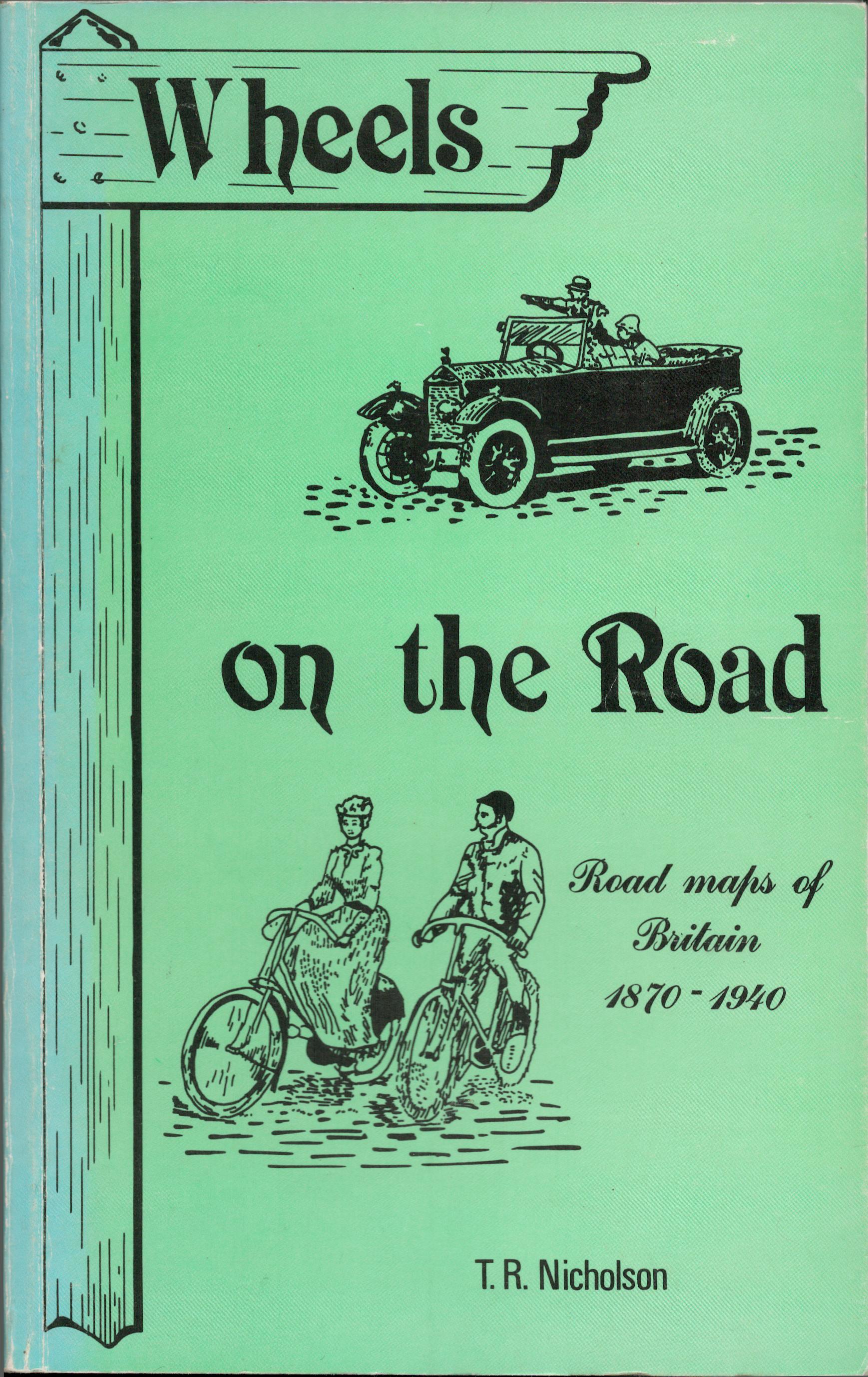 Wheels on the Road: Maps of Britain for the Cyclist and Motorist, 1870-1940
by
Wheels on the Road: Maps of Britain for the Cyclist and Motorist, 1870-1940
by
 Cooking on wheels; a cookbook for travel trailers, pick-up campers, tent campers, motor homes, and all recreational vehicles with cooking facilities
by
A cookbook for all recreational vehicles equipped with cooking. facilities, the recipes in this are divided into three major categories: top of the stove cookery, for those trailers, pick-up campers, tent campers, and motor homes that do not boast an over; oven recipies, for those that do; and a handy group of recipes that take little or no preparation, for both. Other chapters on organizing the trailer kitchen, on equipment, food purchasing. and storage and helpful hints in general, round out well over 200 recipes.
Cooking on wheels; a cookbook for travel trailers, pick-up campers, tent campers, motor homes, and all recreational vehicles with cooking facilities
by
A cookbook for all recreational vehicles equipped with cooking. facilities, the recipes in this are divided into three major categories: top of the stove cookery, for those trailers, pick-up campers, tent campers, and motor homes that do not boast an over; oven recipies, for those that do; and a handy group of recipes that take little or no preparation, for both. Other chapters on organizing the trailer kitchen, on equipment, food purchasing. and storage and helpful hints in general, round out well over 200 recipes.
 The Geography of Bliss
by
Part foreign affairs discourse, part humor, and part twisted self-help guide, The Geography of Bliss takes the reader from America to Iceland to India in search of happiness, or, in the crabby author's case, moments of un-unhappiness.
The Geography of Bliss
by
Part foreign affairs discourse, part humor, and part twisted self-help guide, The Geography of Bliss takes the reader from America to Iceland to India in search of happiness, or, in the crabby author's case, moments of un-unhappiness.
 Penguin on Vacation
by
Geisel Honor-winning author/illustrator Salina Yoon's beloved character Penguin hits the beach in Penguin on Vacation--a charming picture book that's perfect for summer vacation. Penguin is tired of the snow and cold--so he decides to visit the beach! But when his favorite activities like skiing and skating don't work so well on sand, can a new friend help Penguin learn how to have fun in the sun? Seasoned, award-winning author/illustrator Salina Yoon's charming text and bright, energetic illustrations ensure that readers will be clamoring for more Penguin stories--wherever they make their home!
Penguin on Vacation
by
Geisel Honor-winning author/illustrator Salina Yoon's beloved character Penguin hits the beach in Penguin on Vacation--a charming picture book that's perfect for summer vacation. Penguin is tired of the snow and cold--so he decides to visit the beach! But when his favorite activities like skiing and skating don't work so well on sand, can a new friend help Penguin learn how to have fun in the sun? Seasoned, award-winning author/illustrator Salina Yoon's charming text and bright, energetic illustrations ensure that readers will be clamoring for more Penguin stories--wherever they make their home!
 Ruth and the Green Book
by
The picture book inspiration for the Academy Award-winning film The Green Book Ruth was so excited to take a trip in her family's new car! In the early 1950s, few African Americans could afford to buy cars, so this would be an adventure. But she soon found out that black travelers weren't treated very well in some towns. Many hotels and gas stations refused service to black people. Daddy was upset about something called Jim Crow laws . . . Finally, a friendly attendant at a gas station showed Ruth's family The Green Book. It listed all of the places that would welcome black travelers. With this guidebook--and the kindness of strangers--Ruth could finally make a safe journey from Chicago to her grandma's house in Alabama. Ruth's story is fiction, but The Green Book and its role in helping a generation of African American travelers avoid some of the indignities of Jim Crow are historical fact.
Ruth and the Green Book
by
The picture book inspiration for the Academy Award-winning film The Green Book Ruth was so excited to take a trip in her family's new car! In the early 1950s, few African Americans could afford to buy cars, so this would be an adventure. But she soon found out that black travelers weren't treated very well in some towns. Many hotels and gas stations refused service to black people. Daddy was upset about something called Jim Crow laws . . . Finally, a friendly attendant at a gas station showed Ruth's family The Green Book. It listed all of the places that would welcome black travelers. With this guidebook--and the kindness of strangers--Ruth could finally make a safe journey from Chicago to her grandma's house in Alabama. Ruth's story is fiction, but The Green Book and its role in helping a generation of African American travelers avoid some of the indignities of Jim Crow are historical fact.
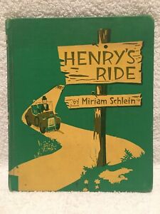 Henry's Ride
by
On a fine day, Henry takes a ride through the country, picking daisies, seeing horses, sheep and pigs, and sharing some peanuts with a farm lady.
Henry's Ride
by
On a fine day, Henry takes a ride through the country, picking daisies, seeing horses, sheep and pigs, and sharing some peanuts with a farm lady.
 A Young Explorer's New York: Maps of Manhattan
by
Brief introductions to various sections, activities and seasons in New York City with 12 double-spread picture maps
A Young Explorer's New York: Maps of Manhattan
by
Brief introductions to various sections, activities and seasons in New York City with 12 double-spread picture maps
